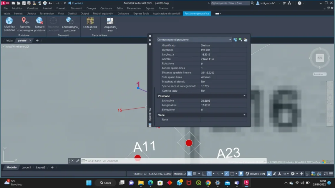
Yes, I am using autocad2023 and I have inserted points that have coordinates with latitude and longitude, now I wanted to export this information to an excel table. With extra data I get blank columns, you know how to do it?
autocad 2023 has integrated some autocad map functions so I could insert a point from which to read latitude and longitude, since I have to insert many I wanted to know if you could export to excel.
I don't know if I was clear
My last goal is to have a table with latlong positions inserted in autocad. for example the table must have three columns name (1) lat (39.8695) long (17.833)
Have you tried to search on google maps the location of those coordinates you wrote? no because to me it turns out in the middle of the sea a few miles off gallipoli
Anyway, as I see it, with autocad you can't automatically get a table as you wish. you should hand-mark for each point latitude and longitude values. Unfortunately, for paperwork, autocad is certainly not the best software