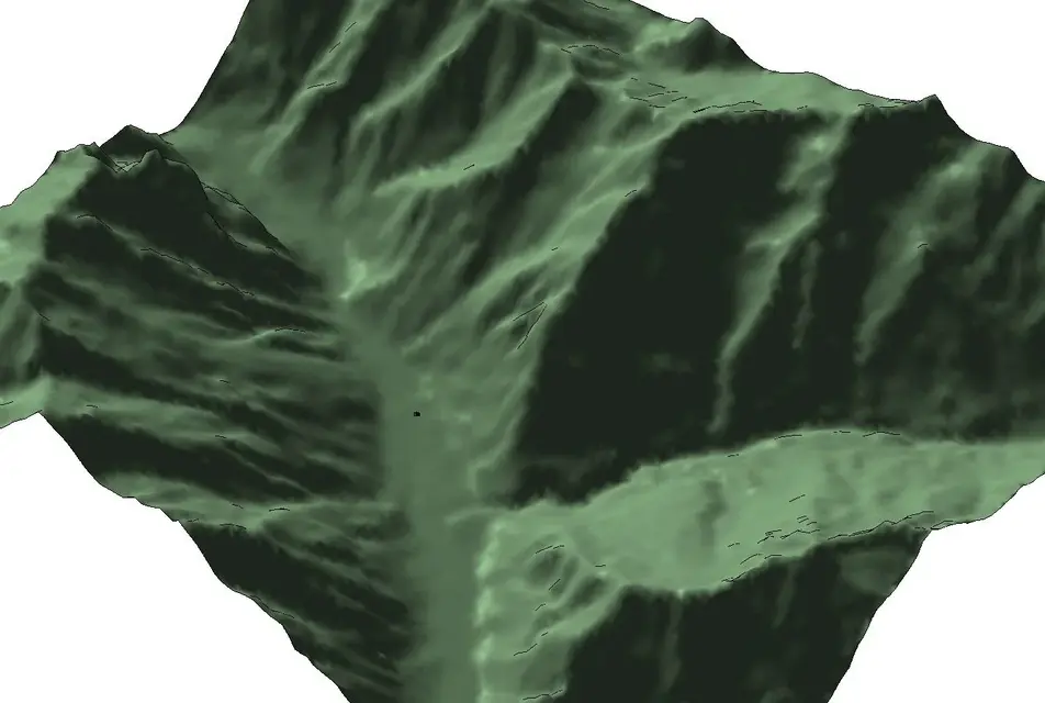
• This forum is the machine-generated translation of www.cad3d.it/forum1 - the Italian design community. Several terms are not translated correctly.

from dtm to dwg file for revit

  • Thread starter Thread starter Grillone
  • Start date Start date
I am puzzled... I would be curious to know what method of modeling you will use to generate mountain-shaped masses
:36_1_5:
You're right, you can't do anything with the mass.

I imported my dwg into revit as I told you before and I associated it with the ground. I'll attach your pictures.
being a grid of square revit wide zoom makes it black.
But if I zoom in on my houses and activate the solar path the shadow of the mountains is real. I'll send you some jpeg.

It's a bit of a maniac job, but it works:
 

Attachments

  • ScreenHunter_08 Feb. 23 23.13.webp
    ScreenHunter_08 Feb. 23 23.13.webp
    50.7 KB · Views: 9
  • ScreenHunter_09 Feb. 23 23.14.webp
    ScreenHunter_09 Feb. 23 23.14.webp
    50.9 KB · Views: 8
  • ScreenHunter_10 Feb. 23 23.15.webp
    ScreenHunter_10 Feb. 23 23.15.webp
    29.1 KB · Views: 8
  • ScreenHunter_11 Feb. 23 23.25.webp
    ScreenHunter_11 Feb. 23 23.25.webp
    63.9 KB · Views: 8
  • ScreenHunter_12 Feb. 23 23.27.webp
    ScreenHunter_12 Feb. 23 23.27.webp
    60.6 KB · Views: 11
.

It's a bit of a maniac job, but it works:
I'll send you more jpeg. I calculated them in April and the shadow of the mountain is real. I know the place and revit correctly calculates the sun.
 

Attachments

  • ScreenHunter_13 Feb. 23 23.27.webp
    ScreenHunter_13 Feb. 23 23.27.webp
    49.4 KB · Views: 2
  • ScreenHunter_14 Feb. 23 23.28.webp
    ScreenHunter_14 Feb. 23 23.28.webp
    36.7 KB · Views: 1
  • ScreenHunter_15 Feb. 23 23.29.webp
    ScreenHunter_15 Feb. 23 23.29.webp
    52.2 KB · Views: 3
being a grid of square revit wide zoom makes it black.
the black color I fear is due to the fairness of the curves. if you have not changed anything you have a curve every meter (too!!). change the fairness and bring it to 100 at least.
 
the black color I fear is due to the fairness of the curves. if you have not changed anything you have a curve every meter (too!!). change the fairness and bring it to 100 at least.
I was just thinking that the problem was this. I'll try and then I'll catch you.
Thanks :finger:
 
the black color I fear is due to the fairness of the curves. if you have not changed anything you have a curve every meter (too!!). change the fairness and bring it to 100 at least.
I can't find where I set the pass. Can you tell me?
Thank you :rolleyes:
 
I think you need to regenerate your isoipse, with a pitch of 100 meters: for curiosity, what program did you use to make them?

:
I simply uploaded the dwg to revit which is the grid attached.
then I told revit to create the soil by associating it with this dwg and revit calculated its levels. I can't find now how to change the line step. I try to put invisible lines and I tell you.
 

Attachments

  • ScreenHunter_01 Feb. 23 15.25.webp
    ScreenHunter_01 Feb. 23 15.25.webp
    322.1 KB · Views: 4
I think you need to regenerate your isoipse, with a pitch of 100 meters: for curiosity, what program did you use to make them?

:
in replacement graphic visibility I first disabled the view of the grid dwg (first screenshot) and then disabled the primary and secondary level curves (second jpeg).

the speed of revit does not change, but at least now you see the shadow of the mountain. I send you two examples with the case in the middle of the valley with and without sun.

The job satisfies me. now summarize the procedure that having understood it in 15 minutes then do everything starting from dtm. after place what understood for utility of others.

Hi.
 

Attachments

  • ScreenHunter_01 Feb. 24 12.07.webp
    ScreenHunter_01 Feb. 24 12.07.webp
    419.4 KB · Views: 7
  • ScreenHunter_02 Feb. 24 12.08.webp
    ScreenHunter_02 Feb. 24 12.08.webp
    57.9 KB · Views: 7
  • ScreenHunter_03 Feb. 24 12.11.webp
    ScreenHunter_03 Feb. 24 12.11.webp
    83.1 KB · Views: 9
  • ScreenHunter_04 Feb. 24 12.13.webp
    ScreenHunter_04 Feb. 24 12.13.webp
    66.4 KB · Views: 8
It is understood that even with google earth I can have an idea of the area, but being able to create it in revit allows me to join it to the project.

I'll give you a google view.

then I prepare the summary post on the procedure.
 

Attachments

  • ScreenHunter_05 Feb. 24 12.33.webp
    ScreenHunter_05 Feb. 24 12.33.webp
    136.9 KB · Views: 9
procedure used:

birth from the dtm of the Piedmont region http://gis.csi.it/repertorio/v3/geo/settcart.htmusing the *.asc utm-wgs file of the section that interests me. the section is 6km x 6km with grill every 50 meters. in my case the location of the house is fortunately almost in the middle of the section and so I just need to use one dtm file for my pane.

use globalmapper http://www.globalmapper.it/I had an old version of 2005.
amount the regional ctr and dtm. I mix the distance from the edges of the square of the map of my house in the map (I serve in revit to center the dtm).

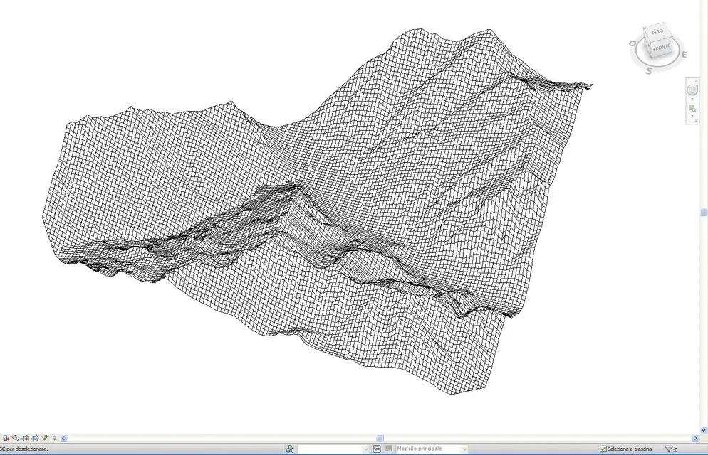
I carry my dtm .asc in dxf. with autocad turn the dxf into dwg.

I amount the dwg in revit and I align it on my house. I use the offset to put zero of the revit level. I imported the dwg into ground floor plan = 0 oriented to the real north.

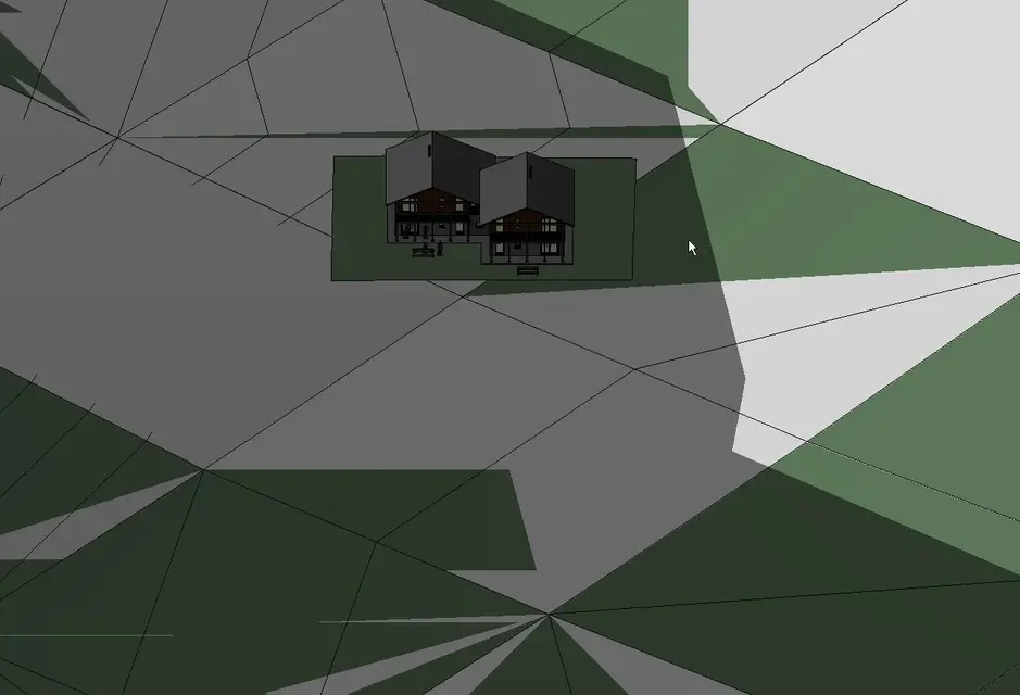
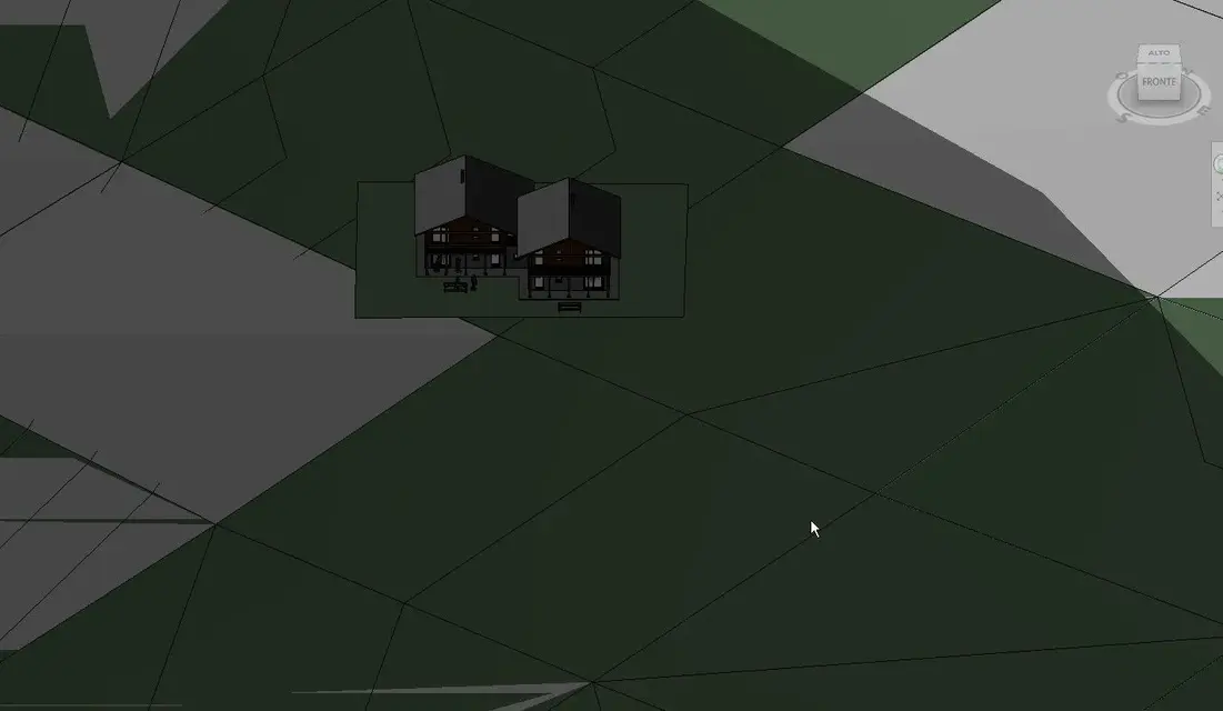
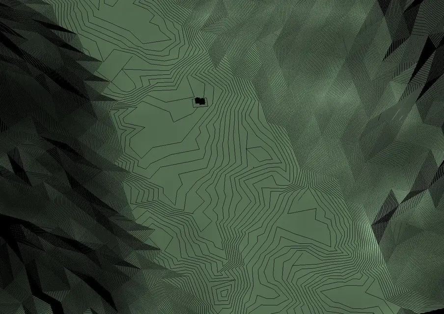
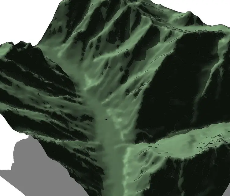
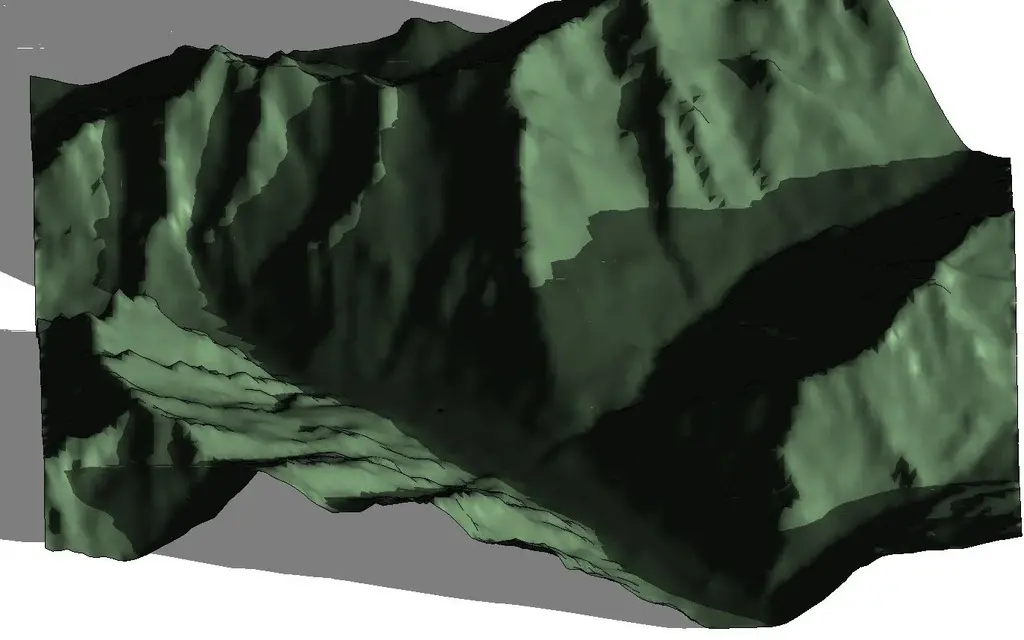
I create a topography (terrene) telling revit to use my dwg file to create the ground. In this way revit creates me the ground. to replace graphical visibility disable the view of the dwg and the topography lines of the primary and secondary level curves.

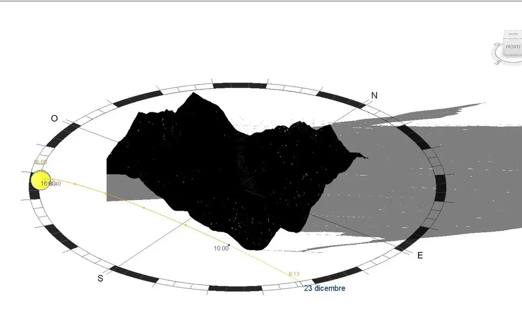
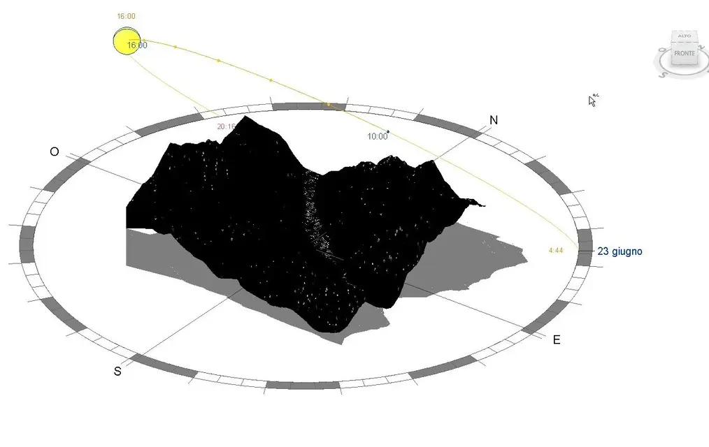
at this point when I activate my sunny path and shadows I can really verify when the mountains send me in shadow the house.

in my pc revit takes 5 seconds to calculate shadows having inserted the mountain.

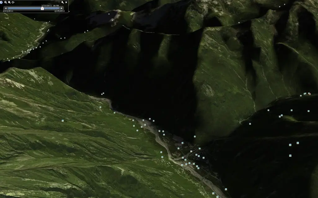
understood how to use globalmapper in 15 minutes step from the dtm of the region to the mountain soil in revit. the work will be a little longer when an area where I have to join and then cut out more sections of dtm files.

for now I am satisfied so.

if you have other ideas and comments write your suggestions.

Hi.
Cricket
 
Cricket,
Let me tell you something: You're a big one.

applausi.gif
 
Cricket,
Let me tell you something: You're a big one.
thank you, too good. I think it's a good thing to use soil morphology in revit.

I have no idea of gis and topography, but having a dtm done well just convert it to dwg and revit does not go mad. Thanks for the help.

bye:
 
but are you really in lungs?

which opensource gis do you use? Is there anything free like globalmapper?
 
but are you really in polo ?
That's right, I'm Italian, I'm working glasses on Polish crossroads. It's a real nemesis.

as to the free competitors of globalmapper, not knowing the latter, I can not say if there are any equivalent, but I can inform myself.

Anyway, as I told you earlier, your revit project has nothing to do with gis, which is a discipline that deals with anything else.

I'll send you an example of typical gis work tomorrow, just to get an idea.

:
 
as promised, here is a example by mini-work gis: It's a study of the unemployment rate in my region.

in summary: gis means linking geographical elements to textual databases, so they derive "intelligent" theme maps.

I would say that in the world gis the pure geometry of the territory is less important than the information ("attributes") associated with it.

rereading the discussion, if you really studied as a mechanical expert, had what you got, it has miraculous, so accept a virtual pacca on your shoulders.. .

:36_1_11:
 

Forum statistics

Threads
44,997
Messages
339,767
Members
4
Latest member
ibt

Members online

No members online now.
Back
Top